We have a couple of fields nearby that we'd searched just the once and briefly then, but which Judy had expressed an interest in searching again, and so, on Sunday afternoon we set out to give them both another try.
This session was just a couple of hours in length but it was enough to establish a few points ...
This session was just a couple of hours in length but it was enough to establish a few points ...
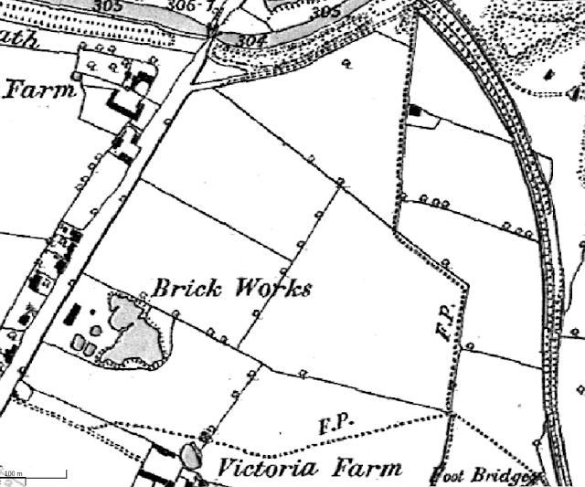
I had done a little map research by overlaying Victorian maps upon modern aerial photographs of the area. I then discovered a few points of interest that I felt would be worth exploring further. Firstly, that there used to be a building on a small plot of land which once lay at the junction of the boundaries of three fields and that these boundaries with their hedgerows and ditches were grubbed up at some time in the recent past and all three enclosures were incorporated into a single larger field.
 |
| Map of 1883. Our permission does not include the two rectangular fields immediately above the brickworks. The house plot mentioned is at top-right and the crossed paths at bottom-right. |
Secondly, I found that a footpath once passed by the building, which turned left and then right and then met with a second footpath which crossed the first. So, we also had crossed paths to look at, which I thought might prove to be more interesting than a path alone.
On the modern aerial map, the house plot and the original field boundaries were all visible. Even the second footpath which seems to have never followed a field boundary has left a faint mark.

Judy set out just to get used to what is to her, a newfangled sport. I had the house plot uppermost in mind. I set out to detect my way there from the field entrance at top-left and along the way found a couple of 20th Century coins and a Late Georgian period drawer handle.
 |
| Judy looking bedraggled in the constant drizzle — and the target seemed hard to locate |
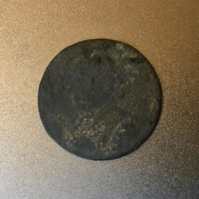
Judy also discovered something that pricked her interest. Nearby to where I knew the house plot to be she'd turned up an apparently blank copper coin disk. However, I could just see something in the way of faint detail and we both agreed that there was a head on one side. Under raking light back at home the obverse seemed to carry a cypher or monogram. I thought it had to be an eighteenth-century farthing token — and it was.
Henry Hickman's Birmingham token of 1792. Issued by Henry Hickman, a wholesale and retail dealer in sheet, bar and rod iron - at 3, Edgbaston Street, Birmingham.
 |
| A proper grot! But Judy is proud of it and I have never seen one before. |
Eventually, the plot was located by scanning the field surface by eye and searching for a limited but fairly dense spread of brick rubble, tile fragments and shards of glass and pottery in dark-coloured soil — and it was what I'd hoped for. The evidence found showed that it probably was a domestic habitation site and not some other type of building because the spread of debris included lots of pottery and also Victorian period clay pipe stem and bowl fragments.
Oddly, although this field supplied plenty of signals, the house plot itself did not seem to hold a great deal more in the way of metallic objects than the land surrounding it. This seemed somewhat unusual, but we will see what comes of it all in good time!
Later we set off for the crossed paths but never quite made it that far. The field in which they lay seemed unusually quiet for one that had a visible spread of pottery upon it and well-coloured soil too. Clearly, it had seen periods of manuring in the past if even it hadn't seen much in the way of on-site activity. Either that or others had detected it to near extinction in the recent past ...
But if so, then why not the top field also?


Another interesting read. Thank you....
ReplyDelete